
Plaetje:California map showing counties (source).xcf

Oearsprunkelik bestandj ((957 × 1.107 pixel, besjtandsgruutde: 363 kB, MIME type: image/x-xcf))
Besjrieving
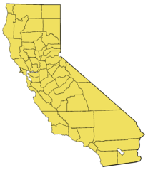
- Based on the modified Commerce Dept. map used in California.
- For en:wikipedia California county links, see also: en: List of California counties.
- Maps by county links
-
- The following maps are scaled down to 200x231, with individual county's highlight layers made visible:
Alameda | Alpine | Amador | Butte | Calaveras | Colusa | Contra Costa | Del Norte | El Dorado | Fresno | Glenn | Humboldt | Imperial | Inyo | Kern | Kings | Lake | Lassen | Los Angeles | Madera | Marin | Mariposa | Mendocino | Merced | Modoc | Mono | Monterey | Napa | Nevada | Orange | Placer | Plumas | Riverside | Sacramento | San Benito | San Bernardino | San Diego | San Francisco | San Joaquin | San Luis Obispo | San Mateo | Santa Barbara | Santa Clara | Santa Cruz | Shasta | Sierra | Siskiyou | Solano | Sonoma | Stanislaus | Sutter | Tehama | Trinity | Tulare | Tuolumne | Ventura | Yolo | Yuba
Source
Uncompressed version of w:File:California map showing counties (source).xcf.gz (gzipped images are not permitted for upload anymore).
Licentie:
This file created by me, w:User:Brion VIBBER, based on the above-referenced file uploaded to meta.wikipedia.org a long time ago (old upload system from 2001/2002). That file claims to be a product of the US Department of Commerce, and should be public domain as a US government product. I claim no additional copyright on the modified image. --Brion 01:06, 14 January 2006 (UTC)
Dit werk bevindt zich in het publieke domein in de Verenigde Staten omdat het is vervaardigd door een ambtenaar van de Amerikaanse federale overheid tijdens de uitoefening van zijn functie, en het daarmee volgens Titel 17, Hoofdstuk 1, Sectie 105 van de United States Code [Engelstalige link] een werk van de Amerikaanse federale overheid [Engelstalige link] is.
Nota bene: Het bovenstaande is alleen van toepassing op werken van de federale overheid of een van haar onderdelen, en niet op werken van een afzonderlijk(e) Staat, Territorium, Commonwealth, County, Gemeente, of enig andere bestuurlijke eenheid. Dit sjabloon is ook niet van toepassing op ontwerpen voor postzegels, door de United States Postal Service openbaar gemaakt sinds 1978 [Engelstalige link]. Zie Art. 206.02(b) van "Compendium II: Copyright Office Practices" (Engelstalig).
|
 | |
| Van dit bestandj is vasgesteld det t'r gein bekindje sjrieversaansprake op ruste, inbegrepe van anger kórtbie rechte. | ||
Original Wikipedia upload log
- 06:36, 9 September 2002 (84 KB) w:User:Brion VIBBER (Base image for the California county maps (GIMP image))
|
Deze XCF rasterafbeelding is gemaakt met GIMP.
|
Besjtandshistorie
Klik op 'ne datum/tied óm 't besjtand te zeen wie 't oetzaog op det tiedsjtip.
| Datum/Tied | Miniatuurplaetje | Aafmaetinge | Gebroeker | Kómmentaar | |
|---|---|---|---|---|---|
| hujig | 16 fib 2009 00:45 |  | 957 × 1.107 (363 kB) | Papa November | == Summary == Base image for the California county maps (GIMP image). Based on the [http://meta.wikipedia.com/upload/California_Map.jpg modified Commerce Dept map] used in California. The following maps are scaled |
Plaetjesverwiezinge
Gein inkel pazjena gebroek dit plaetje.