
Plaetje:Liège agglomération Liège Belgium Map.PNG
Gein hoeger resolutie besjikbaar.
Liège_agglomération_Liège_Belgium_Map.PNG ((800 × 590 pixel, besjtandsgruutde: 76 kB, MIME type: image/png))

|
Deze kaartafbeelding zou opnieuw moeten worden aangemaakt als een SVG-bestand door vectorafbeeldingen te gebruiken. Dit heeft een aantal voordelen; zie Commons:Media for cleanup voor meer informatie. Als er een SVG-formaat van deze afbeelding bestaat, dan deze graag uploaden. Nadat u dit heeft gedaan, gelieve dit sjabloon te vervangen door het sjabloon {{vector version available|nieuwe bestandsnaam.svg}} op deze afbeeldingspagina.
|
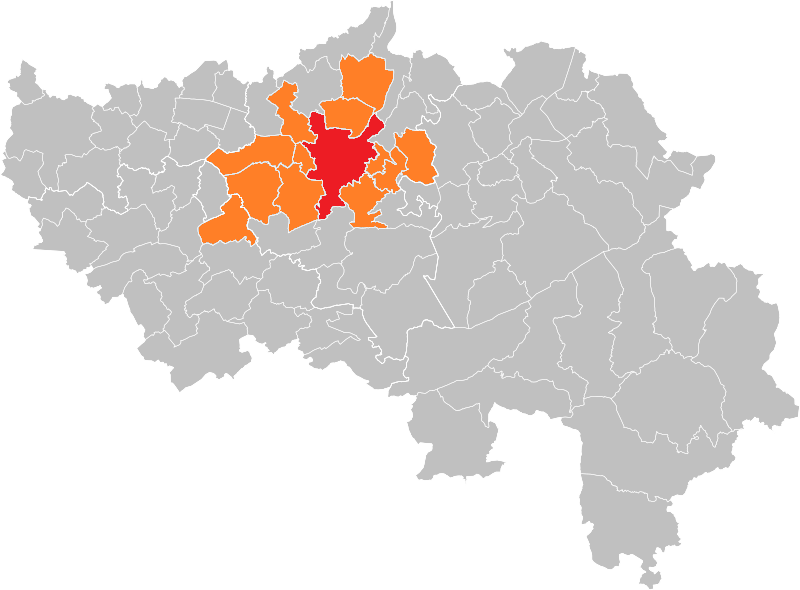
| Besjrieving |
Français : Carte de l'agglomération opérationnelle de Liège.
English: Map of the operational agglomeration. |
||
| Brón |
Eige werk (Map from w:nl:Gebruiker:LennartBolks/kaartenhoekje in Public Domain by the Author choice) |
||
| Sjriever | User:LennartBolks | ||
| Permissie (Hergebroek van dit besjtandj) |
|
Besjtandshistorie
Klik op 'ne datum/tied óm 't besjtand te zeen wie 't oetzaog op det tiedsjtip.
| Datum/Tied | Miniatuurplaetje | Aafmaetinge | Gebroeker | Kómmentaar | |
|---|---|---|---|---|---|
| hujig | 20 apr 2020 18:08 | | 800 × 590 (76 kB) | Sigorix | Mise à jour de l'agglomération opérationnelle |
| 22 dec 2005 16:38 |  | 290 × 220 (7 kB) | Jrenier | Map, belgium, city of Liège ans suburbs (600000 people) {{PD}} FR; Carte indiquant la localisation de l'agglomération de Liège (600000 habitants) dans la Province de Liège. EN; Map from w:nl:Gebruiker:LennartBolks/kaartenhoekje in Public Domain b |
Plaetjesverwiezinge
Dit plaetje weurt op de volgende pazjena's gebroek: