
Plaetje:East Timor location map 2003-2015.svg

Aafmaetinge van dees veurbesjoewing van 't type PNG van dit SVG-bestandj: 800 × 489 pixels Anger resoluties: 320 × 196 pixels | 640 × 391 pixels | 1.024 × 626 pixels | 1.280 × 783 pixels | 2.560 × 1.565 pixels | 1.701 × 1.040 pixels.
Oearsprunkelik bestandj (SVG-bestandj, nominaal 1.701 × 1.040 pixels, bestandsgruutde: 201 kB)
Besjrieving
| Besjrieving |
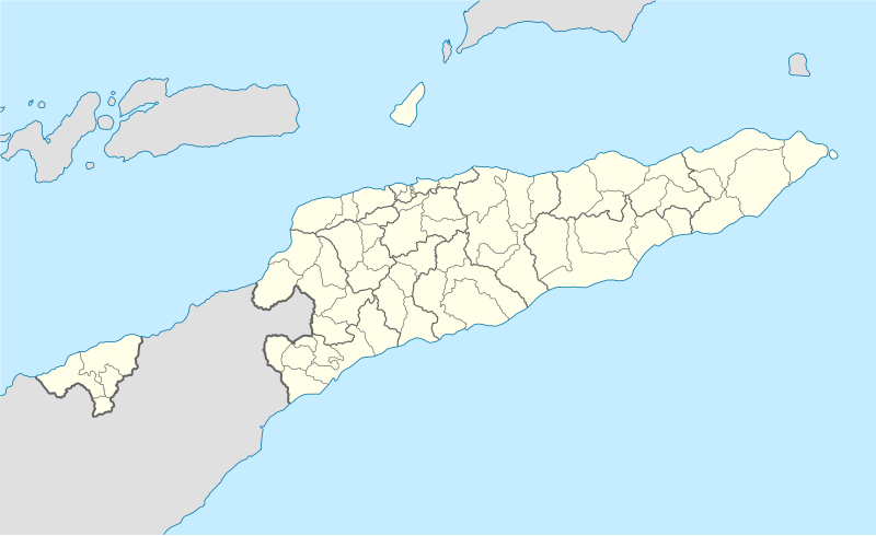
Deutsch: Positionskarte von Osttimor, Grenzen von 2003–2015
Quadratische Plattkarte. Geographische Begrenzung der Karte:
English: Location map of East Timor
Equirectangular projection. Geographic limits of the map:
|
||
| Datum | |||
| Brón |
Eige werk using
|
||
| Sjriever | NordNordWest | ||
| Anger versies |
East Timor relief location map.jpg:  Equivalent physical map Equivalent physical map |
||
| SVG ontwikkeling | De broncode van dit SVG-bestand is deugdelijk.
|

Licentie:
Ich, de kopierechhaajer hievan, bring 't hiebie óngere vólgendje lisensje oet:

|
Toesteumming wert verleend veur t kopiëre, verspreide en/of wiezige van dit document onger de veurwaerd van de GNU-licentie veur vrieje documentatie, versie 1.2 of einige latere versie es gepubliceerd door de Free Software Foundation; zonger Invariant Sections, zonger Front-Cover Texts, en zonger Back-Cover Texts. n kopie van de licentie is opgenomme in de sectie GNU-licentie veur vrieje documentatie. |
Dit bestandj steit gelicenseerdj óngere Creative Commons Attribution 3.0 Unported lisensje.
- De maags:
- deile – aafsjrieve, verspreie en dórchgaeve
- hèrminge – 't wèrk aanpasje
- Óngere volgendje veurwaerj:
- Attribuusje – Geer mótj op 'n gepasdje meneer 'n naamsvermeljing make, 'ne link nao de licentie opgaeve, en aangaeve of g'r 't werk verangerd höb. Geer moog dit op eder raejelike meneer doon, meh neet zoea det 't liek ofwen de licentiegaever instump mit eur werk of eur gebroek van zie werk.
De kens zelf de lisensje oetkeze.
Besjtandshistorie
Klik op 'ne datum/tied óm 't besjtand te zeen wie 't oetzaog op det tiedsjtip.
| Datum/Tied | Miniatuurplaetje | Aafmaetinge | Gebroeker | Kómmentaar | |
|---|---|---|---|---|---|
| hujig | 27 mei 2009 18:17 | | 1.701 × 1.040 (201 kB) | NordNordWest | completed |
| 25 mei 2009 18:19 |  | 1.701 × 1.040 (126 kB) | NordNordWest | c | |
| 25 mei 2009 18:11 |  | 1.701 × 1.040 (126 kB) | NordNordWest | {{Information |Description= {{de|Positionskarte von Osttimor}} Quadratische Plattkarte. Geographische Begrenzung der Karte: * N: 7.8° S * S: 10.0° S * W: 123.9° O * O: 127.5° O {{en|Location map of East Timor}} Equi |
Plaetjesverwiezinge
Gein inkel pazjena gebroek dit plaetje.
Globaal besjtandjsgebroek
De volgende anger wiki's gebroeke dit bestandj:
- Gebroek in bn.wikipedia.org
- Gebroek in de.wikipedia.org
- Gebroek in es.wikipedia.org
- Gebroek in fr.wikinews.org
- Gebroek in ia.wikipedia.org
- Gebroek in incubator.wikimedia.org
- Gebroek in pt.wikipedia.org
- Gebroek in www.wikidata.org