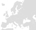
Plaetje:Blank map Europe with borders.png

Gruutde van dees veurvertuining: 719 × 600 pixels. Anger resoluties: 288 × 240 pixels | 576 × 480 pixels | 921 × 768 pixels | 1.200 × 1.001 pixels.
Oearsprunkelik bestandj ((1.200 × 1.001 pixel, besjtandsgruutde: 50 kB, MIME type: image/png))
Besjtandshistorie
Klik op 'ne datum/tied óm 't besjtand te zeen wie 't oetzaog op det tiedsjtip.
| Datum/Tied | Miniatuurplaetje | Aafmaetinge | Gebroeker | Kómmentaar | |
|---|---|---|---|---|---|
| hujig | 21 jan 2018 19:42 |  | 1.200 × 1.001 (50 kB) | Koreanovsky | Border fix: Bosnia and Herzegovina and Croatia |
| 15 dec 2011 15:03 |  | 1.200 × 1.000 (19 kB) | Mayhaymate | Optimized with PNGOUT | |
| 19 apr 2010 01:32 |  | 1.200 × 1.000 (24 kB) | Bernerd | Reverted to version as of 18:09, 7 August 2008 | |
| 13 sep 2008 16:44 |  | 1.200 × 1.000 (33 kB) | Avala | ||
| 7 aug 2008 20:09 |  | 1.200 × 1.000 (24 kB) | San Jose | ||
| 19 jul 2006 21:40 |  | 1.200 × 1.000 (33 kB) | San Jose | * Description: Blank map of Europe * Source: Own map, based on the maps of [https://www.cia.gov/cia/publications/factbook/index.html The World Factbook] * Author: San Jose, 19. July 2006 {{PD-USGov-CIA-WF}} [[Category:Blank maps of Eur |
Plaetjesverwiezinge
Gein inkel pazjena gebroek dit plaetje.
Globaal besjtandjsgebroek
De volgende anger wiki's gebroeke dit bestandj:
- Gebroek in en.wiktionary.org
- Scotland
- Norveç
- Italia
- تركيا
- Europa
- Estland
- Türkiye
- ألمانيا
- Yunanistan
- Ermenistan
- روسيا
- इटली
- ترکی
- საქართველო
- Kıbrıs
- آئرلینڈ
- საფრანგეთი
- საბერძნეთი
- თურქეთი
- یونان
- Norþweg
- Finlandiya
- यूरोप
- इंग्लैंड
- एस्टोनिया
- Norweskô
- انگلستان
- برطانیہ
- ألبانيا
- आयरलैंड
- İspanya
- Bulgaristan
- İzlanda
- İskoçya
- Macaristan
- Almanya
- Avrupa
- Polonya
- Danimarka
- Belçika
- Avusturya
- Arnavutluk
- فرنسا
- Ukrajina
- İsviçre
- إنكلترا
- İngiltere
- İsveç
- Romanya
- Rusya
Bekiek wikiwied gebroek van dit bestandj.


