Plaetje:BlankMap-Europe.png

Pagina-inhoud wordt niet ondersteund in andere talen.
Van Wikipedia

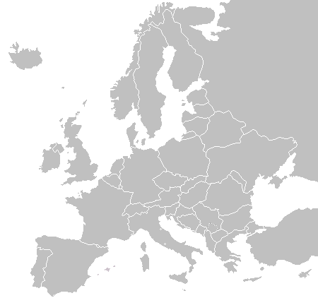
BlankMap-Europe.png((450 × 422 pixel, besjtandsgruutde: 15 kB, MIME type: image/png))

Dit besjtandj kump van Wikimedia Commons en kin ouch in anger projekte gebroek waere. De pagina mit de besjtandjsbesjrieving wurt hiejónger weergegaeve.

Bestand:Blank map of Europe cropped.svg is een vectorversie van dit bestand. Indien niet van slechtere kwaliteit dient deze gebruikt te worden in plaats van deze rasterafbeelding.

File:BlankMap-Europe.png → File:Blank map of Europe cropped.svg

Zie Help:SVG voor meer informatie.

In andere talen
Alemannisch  Bahasa Indonesia  Bahasa Melayu  British English  català  čeština  dansk  Deutsch  eesti  English  español  Esperanto  euskara  français  Frysk  galego  hrvatski  Ido  italiano  lietuvių  magyar  Nederlands  norsk bokmål  norsk nynorsk  occitan  Plattdüütsch  polski  português  português do Brasil  română  Scots  sicilianu  slovenčina  slovenščina  suomi  svenska  Tiếng Việt  Türkçe  vèneto  Ελληνικά  беларуская (тарашкевіца)  български  македонски  нохчийн  русский  српски / srpski  татарча/tatarça  українська  ქართული  հայերեն  বাংলা  தமிழ்  മലയാളം  ไทย  한국어  日本語  简体中文  繁體中文  עברית  العربية  فارسی  +/−
SVG-bestand

Besjrieving

Besjrieving
English: A blank political map of Europe as of 2004 (updated 2006 and 2008), made by the uploader for Wikipedia.
The list of independent states pictured on the map (source): Albania, Andorra, Austria, Belarus, Belgium, Bosnia and Herzegovina, Bulgaria, Croatia, Czech Republic, Cyprus, Denmark, Estonia, Finland, France, Germany, Greece, Hungary, Iceland, Ireland, Italy, Latvia, Liechtenstein, Lithuania, Luxembourg, Kosovo (disputed), Macedonia, Moldova, Monaco, Montenegro, Netherlands, Norway, Poland, Portugal, Romania, Russia, San Marino, Serbia, Slovakia, Slovenia, Spain, Sweden, Switzerland, Turkey, Ukraine, United Kingdom, Vatican City
Datum 16 november 2003 (originele uploaddatum)
Brón Eige werk
Sjriever Vardion op de Engelstalige Wikipedia

Licentie:

Public domain Iech, de autäörsrechhöbbende vaan dit wirk, geef dit wirk vrij in 't publiek domein. Dit is wereldwijd vaan toupassing.
In sommig len is dit wettelik neet meugelek; in die gevalle gelt:
Ich staon ederein toe dit wirk veur ènnig doel te broeke, zónger ènnig veurwaerj, behauve zölk veurwaerj dóre wet waere veurgesjreve.

Orzjineel uploadlogbook

The original description page was here. All following user names refer to en.wikipedia.
  • 2006-06-10 12:08 Astrokey44 422×422 (10216 bytes) montenegro independent
  • 2006-04-23 18:32 Lgriot 450×422 (7164 bytes) Reverted to earlier revision
  • 2006-04-23 18:32 Lgriot 415×422 (9421 bytes) Reverted to earlier revision
  • 2006-02-22 07:01 BionicWilliam 450×422 (9812 bytes) Reverted to earlier revision
  • 2006-02-22 07:01 BionicWilliam 415×422 (9421 bytes) Reverted to earlier revision
  • 2006-01-04 08:52 E Pluribus Anthony 450×422 (9812 bytes) Blank map of Europe (2005)
  • 2005-09-22 18:14 E Pluribus Anthony 450×422 (9805 bytes) Blank map of Europe (2005)
  • 2005-09-19 09:15 E Pluribus Anthony 450×422 (9804 bytes) Blank map of Europe, 2005
  • 2005-09-19 06:45 E Pluribus Anthony 450×422 (7164 bytes) Blank map of Europe
  • 2005-07-21 05:05 MishaChan 415×422 (5477 bytes) Reverted to earlier revision
  • 2005-07-21 05:04 MishaChan 415×422 (9421 bytes) Reverted to earlier revision
  • 2005-01-22 16:48 Richie 415×422 (5477 bytes) modified Ireland (border), Orkney, Shetlands
  • 2004-09-07 10:53 Gobnuts 415×422 (9421 bytes) Reverted to earlier revision
  • 2004-09-07 10:51 Gobnuts 415×422 (9410 bytes) Reverted to earlier revision
  • 2003-11-16 08:07 Vardion 415×422 (9421 bytes) Blank map of Europe (corrected again)
  • 2003-11-16 08:04 Vardion 415×422 (9410 bytes) Blank map of Europe (corrected)
  • 2003-11-16 07:16 Vardion 415×430 (9113 bytes) Blank map of Europe

Bijschriften

Beschrijf in één regel wat dit bestand voorstelt

Items getoond in dit bestand

beeldt af Nederlands

16 nov 2003

MIME-type Nederlands

image/png

checksum Nederlands

fd8d2f1165f0bd5741de4e44d0bdfd3444feb56e

methode van vaststelling Nederlands: SHA-1 Nederlands

datagrootte Nederlands

14.906 byte

hoogte Nederlands

422 pixel

breedte Nederlands

450 pixel

Besjtandshistorie

Klik op 'ne datum/tied óm 't besjtand te zeen wie 't oetzaog op det tiedsjtip.

(nuujste | aadste) (nujer 10) () (10 | 20 | 50 | 100 | 250 | 500) bekieke.
Datum/TiedMiniatuurplaetjeAafmaetingeGebroekerKómmentaar
hujig24 sep 2015 00:02Miniatuurplaetje veur versie per 24 sep 2015 00:02450 × 422 (15 kB)OgreBot(BOT): Reverting to most recent version before archival
24 sep 2015 00:02Miniatuurplaetje veur versie per 24 sep 2015 00:02450 × 422 (10 kB)OgreBot(BOT): Uploading old version of file from en.wikipedia; originally uploaded on 2006-01-04 08:52:21 by E Pluribus Anthony
24 sep 2015 00:02Miniatuurplaetje veur versie per 24 sep 2015 00:02450 × 422 (10 kB)OgreBot(BOT): Uploading old version of file from en.wikipedia; originally uploaded on 2005-09-22 18:14:10 by E Pluribus Anthony
24 sep 2015 00:02Miniatuurplaetje veur versie per 24 sep 2015 00:02450 × 422 (10 kB)OgreBot(BOT): Uploading old version of file from en.wikipedia; originally uploaded on 2005-09-19 09:15:43 by E Pluribus Anthony
24 sep 2015 00:02Miniatuurplaetje veur versie per 24 sep 2015 00:02450 × 422 (7 kB)OgreBot(BOT): Uploading old version of file from en.wikipedia; originally uploaded on 2005-09-19 06:45:22 by E Pluribus Anthony
24 sep 2015 00:02Miniatuurplaetje veur versie per 24 sep 2015 00:02415 × 422 (5 kB)OgreBot(BOT): Uploading old version of file from en.wikipedia; originally uploaded on 2005-01-22 16:48:46 by Richie
24 sep 2015 00:01Miniatuurplaetje veur versie per 24 sep 2015 00:01415 × 422 (9 kB)OgreBot(BOT): Uploading old version of file from en.wikipedia; originally uploaded on 2003-11-16 08:04:27 by Vardion
24 sep 2015 00:01Miniatuurplaetje veur versie per 24 sep 2015 00:01415 × 430 (9 kB)OgreBot(BOT): Uploading old version of file from en.wikipedia; originally uploaded on 2003-11-16 07:16:14 by Vardion
21 jul 2009 21:27Miniatuurplaetje veur versie per 21 jul 2009 21:27450 × 422 (15 kB)Hoshiefixed Montenegro
18 jul 2009 10:20Miniatuurplaetje veur versie per 18 jul 2009 10:20450 × 422 (15 kB)Hoshieredid Kosovo/Montenegro borders based on an older version of File:Continental-Europe-map.png; anti-aliasing has been removed.
(nuujste | aadste) (nujer 10) () (10 | 20 | 50 | 100 | 250 | 500) bekieke.

Gein inkel pazjena gebroek dit plaetje.

Globaal besjtandjsgebroek

De volgende anger wiki's gebroeke dit bestandj:

Metadata

Aafkomstig van Wikipedia, de Vriej Encyclopedie. "https://li.wikipedia.org/wiki/Plaetje:BlankMap-Europe.png"