
Plaetje:South America laea relief location map.jpg

Gruutde van dees veurvertuining: 409 × 600 pixels. Anger resoluties: 163 × 240 pixels | 327 × 480 pixels | 524 × 768 pixels | 1.181 × 1.732 pixels.
Oearsprunkelik bestandj ((1.181 × 1.732 pixel, besjtandsgruutde: 1,71 MB, MIME type: image/jpeg))
Besjrieving
| Besjrieving |
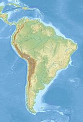
English: Relief location map of SouthAmerica.
|
| Datum | |
| Brón | Eige werk |
| Sjriever | Uwe Dedering |
Licentie:
Ich, de kopierechhaajer hievan, bring 't hiebie óngere vólgendje lisensje oet:
Dit bestandj steit gelicenseerdj óngere Creative Commons Attribution-Share Alike 3.0 Unported lisensje.
- De maags:
- deile – aafsjrieve, verspreie en dórchgaeve
- hèrminge – 't wèrk aanpasje
- Óngere volgendje veurwaerj:
- Attribuusje – Geer mótj op 'n gepasdje meneer 'n naamsvermeljing make, 'ne link nao de licentie opgaeve, en aangaeve of g'r 't werk verangerd höb. Geer moog dit op eder raejelike meneer doon, meh neet zoea det 't liek ofwen de licentiegaever instump mit eur werk of eur gebroek van zie werk.
- Deil gliek – Went geer dit werk geremix, verangerd of doorverwirk höb, mótj geer 't verangerd matterjaal verspreie ónger dezelfde licentie wie 't oersjprunkelik werk, of 'n licentie die daomit samegeit.

|
Toesteumming wert verleend veur t kopiëre, verspreide en/of wiezige van dit document onger de veurwaerd van de GNU-licentie veur vrieje documentatie, versie 1.2 of einige latere versie es gepubliceerd door de Free Software Foundation; zonger Invariant Sections, zonger Front-Cover Texts, en zonger Back-Cover Texts. n kopie van de licentie is opgenomme in de sectie GNU-licentie veur vrieje documentatie. |
De kens zelf de lisensje oetkeze.
Besjtandshistorie
Klik op 'ne datum/tied óm 't besjtand te zeen wie 't oetzaog op det tiedsjtip.
| Datum/Tied | Miniatuurplaetje | Aafmaetinge | Gebroeker | Kómmentaar | |
|---|---|---|---|---|---|
| hujig | 27 nov 2010 14:50 | | 1.181 × 1.732 (1,71 MB) | Uwe Dedering | {{Information |Description={{en|1= Relief location map of SouthAmerica. * Projection: Lambert azimuthal equal-area projection. * Area of interest: :* N: 25.0° N :* S: -60.0° N :* W: -90.0° E :* E: -30.0° E * Projection center: :* NS: -17.5° N :* WE: |
Plaetjesverwiezinge
Gein inkel pazjena gebroek dit plaetje.
Globaal besjtandjsgebroek
De volgende anger wiki's gebroeke dit bestandj:
- Gebroek in als.wikipedia.org
- Gebroek in ar.wikipedia.org
- Gebroek in ast.wikipedia.org
- Gebroek in av.wikipedia.org
- Gebroek in azb.wikipedia.org
- Gebroek in az.wikipedia.org
- And dağları
- Amazon çayı
- Robinzon Kruzo adası
- Aleksandr Selkirk adası
- Santa Klara adası
- Kopaue
- Şablon:Yer xəritəsi Cənubi Amerika
- İquiqe zəlzələsi (2014)
- İquasu Milli Parkı (Argentina)
- İquasu (şəlalə)
- Serra-du-Mar
- Magellan boğazı
- Dreyk boğazı
- Biql boğazı
- Valdivia zəlzələsi (1960)
- Grau dənizi
- Argentina dənizi
- Pataqoniya arxipelaqı
- Qalinas burnu
- Frоuаrd burnu
- Parinyas burnu
- Seyşas burnu
- Tietе
- Quayra şəlaləsi
- Lyulyaylyako milli parkı
- Kabu-Branku burnu
- Moça adası
- Benxamin adası
- Quamblin adası
- Ceyms adası (Çili)
- Viktoriya adası (Çili)
- Kuptana adası
- Melçor adası
- Rivero adası
- Trayqen adası
- San Ambrosio
- Doson adası
Bekiek wikiwied gebroek van dit bestandj.