
Plaetje:Map of federal subjects of Russia (2022), disputed Crimea and Donbass.svg

Aafmaetinge van dees veurbesjoewing van 't type PNG van dit SVG-bestandj: 512 × 282 pixels Anger resoluties: 320 × 176 pixels | 640 × 353 pixels | 1.024 × 564 pixels | 1.280 × 705 pixels | 2.560 × 1.410 pixels.
Oearsprunkelik bestandj (SVG-bestandj, nominaal 512 × 282 pixels, bestandsgruutde: 827 kB)
,_disputed_Crimea_and_Donbass.svg)
 Dit bestand is genomineerd voor verwijdering sinds 1 mei 2024. Voor overleg hierover, zie hier.
Verwijder dit label niet voordat het verwijderverzoek is gesloten. Reden voor het verwijderverzoek: на даному файлі показано незаконно захоплені території АР Крим. Що являється пропагандою тероризму, а також та оправданням війни.
| |||
| |||
,_disputed_Crimea_and_Donbass.svg)
,_disputed_Crimea_and_Donbass.svg)

|
The boundaries on this map show the de facto situation. This is just one of several different views on the subject (see COM:NPOV). |
Besjrieving
| Besjrieving |
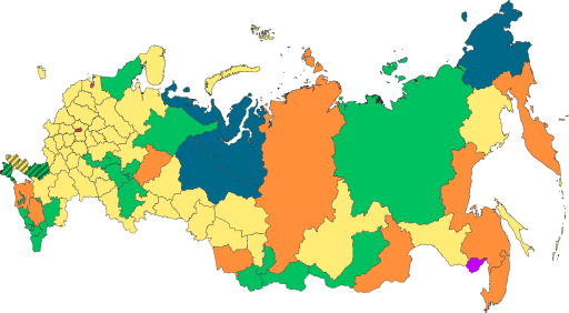
English: Copy of File:Map of federal subjects of Russia (2022).svg with disputed annexed Ukrainian territories indicated with diagonal stripes |
| Datum | |
| Brón |
Dit bestand is afgeleid van: Map of federal subjects of Russia 2014, disputed Crimea.svg |
| Sjriever | Mzajac, Ltbubbas |
.svg)
Licentie:
| This map is ineligible for copyright and therefore in the public domain, because it consists entirely of information that is common property and contains no original authorship. For more information, see Commons:Threshold of originality § Maps.
|
Besjtandshistorie
Klik op 'ne datum/tied óm 't besjtand te zeen wie 't oetzaog op det tiedsjtip.
| Datum/Tied | Miniatuurplaetje | Aafmaetinge | Gebroeker | Kómmentaar | |
|---|---|---|---|---|---|
| hujig | 4 okt 2022 21:48 | | 512 × 282 (827 kB) | Techso01 | Uploaded a work by Mzajac, Ltbubbas from {{derived from|Map of federal subjects of Russia (2014), disputed Crimea.svg}} with UploadWizard |
Plaetjesverwiezinge
Gein inkel pazjena gebroek dit plaetje.
Globaal besjtandjsgebroek
De volgende anger wiki's gebroeke dit bestandj:
- Gebroek in ab.wikipedia.org
- Gebroek in ar.wikipedia.org
- Gebroek in ast.wikipedia.org
- Gebroek in be.wikipedia.org
- Gebroek in cs.wikipedia.org
- Gebroek in de.wikipedia.org
- Gebroek in en.wikipedia.org
- Gebroek in es.wikipedia.org
- Gebroek in fa.wikipedia.org
- Gebroek in fr.wikipedia.org
- Gebroek in is.wikipedia.org
- Gebroek in it.wikipedia.org
- Gebroek in ja.wikipedia.org
- Gebroek in ko.wikipedia.org
- Gebroek in la.wikipedia.org
- Gebroek in lez.wikipedia.org
- Gebroek in lld.wikipedia.org
- Gebroek in lt.wikipedia.org
- Gebroek in lv.wikipedia.org
- Gebroek in mi.wikipedia.org
- Gebroek in oc.wikipedia.org
- Gebroek in pt.wikipedia.org
- Gebroek in ru.wikipedia.org
- Gebroek in sl.wikipedia.org
- Gebroek in sr.wikipedia.org
- Gebroek in th.wikipedia.org
- Gebroek in tly.wikipedia.org
- Gebroek in tum.wikipedia.org
- Gebroek in uk.wikipedia.org
- Gebroek in uz.wikipedia.org
- Gebroek in vi.wikipedia.org
Bekiek wikiwied gebroek van dit bestandj.
,_disputed_Crimea_and_Donbass.svg)
,_disputed_Crimea_and_Donbass.svg)