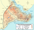
Plaetje:Byzantine Constantinople-tr.png
Uiterlijk

Gruutde van dees veurvertuining: 664 × 599 pixels. Anger resoluties: 266 × 240 pixels | 532 × 480 pixels | 851 × 768 pixels | 1.135 × 1.024 pixels | 2.269 × 2.048 pixels | 3.075 × 2.775 pixels.
Oearsprunkelik bestandj ((3.075 × 2.775 pixel, besjtandsgruutde: 3,08 MB, MIME type: image/png))
Besjtandshistorie
Klik op 'ne datum/tied óm 't besjtand te zeen wie 't oetzaog op det tiedsjtip.
| Datum/Tied | Miniatuurplaetje | Aafmaetinge | Gebroeker | Kómmentaar | |
|---|---|---|---|---|---|
| hujig | 8 aug 2010 20:53 |  | 3.075 × 2.775 (3,08 MB) | İnfoCan | {{Information |Description= |Source= |Date= |Author= |Permission= |other_versions= }} |
| 9 jul 2010 01:26 |  | 3.075 × 2.775 (3,08 MB) | InfoCan | ||
| 9 jul 2010 01:24 |  | 3.075 × 2.775 (3,08 MB) | InfoCan | {{Information |Description= |Source= |Date= |Author= |Permission= |other_versions= }} | |
| 9 jul 2010 00:44 |  | 3.075 × 2.775 (3,08 MB) | InfoCan | {{Information |Description={{en|1=Topographical map of Constantinople during the Byzantine period. Main map source: R. Janin, ''Constantinople Byzantine. Developpement urbain et repertoire topographique''. Road network and some ot |
Plaetjesverwiezinge
Gein inkel pazjena gebroek dit plaetje.
Globaal besjtandjsgebroek
De volgende anger wiki's gebroeke dit bestandj:
- Gebroek in arc.wikipedia.org
- Gebroek in az.wikipedia.org
- Gebroek in tr.wikipedia.org
- İstanbul'un Fethi
- Konstantinopolis
- İstanbul'un yedi tepesi
- İstanbul kuşatmaları listesi
- Konstantinopolis Kuşatması (1204)
- Konstantinopolis Kuşatması (1235-1236)
- Vikipedi:Günün seçkin resmi/Nisan 2011
- Vikipedi:Seçkin resimler/Çizimler, diyagramlar ve haritalar/Haritalar
- Vikipedi:Seçkin resim adayları/Byzantine Constantinople-tr.png
- Bayrampaşa Deresi
- Theodosius Limanı
- Blakernai
- Kullanıcı mesaj:İnfoCan/arşiv20
- Bizans-Ceneviz Savaşı
- Vikipedi:Seçkin resimler/Ana sayfaya çıkmış resimler/2011 listesi
- Şablon:GSR/2011-04-22
- Latin Katliamı
- Vikipedi:Günün seçkin resmi/Mart 2014
- Şablon:GSR/2014-03-29
- Vikipedi:Seçkin resimler/Ana sayfaya çıkmış resimler/2014 listesi
- Slav Thomas
- Kontoskalion
- Prosforion Limanı
- Notitia Urbis Constantinopolitanae
- Arkadios Forumu
- Konstantinopolis Muharebesi (922)
- Hodegon Manastırı
- Kasımağa Mescidi
- Vikipedi:Günün seçkin resmi/Haziran 2020
- Şablon:GSR/2020-06-29
- Ese Kapı Camii
- Toklu Dede Mescidi
