
Plaetje:Vondelk1.jpg
Gruutde van dees veurvertuining: 381 × 600 pixels. Anger resoluties: 152 × 240 pixels | 305 × 480 pixels | 940 × 1.480 pixels.
Oearsprunkelik bestandj ((940 × 1.480 pixel, besjtandsgruutde: 419 kB, MIME type: image/jpeg))
Besjrieving
| Besjrieving |
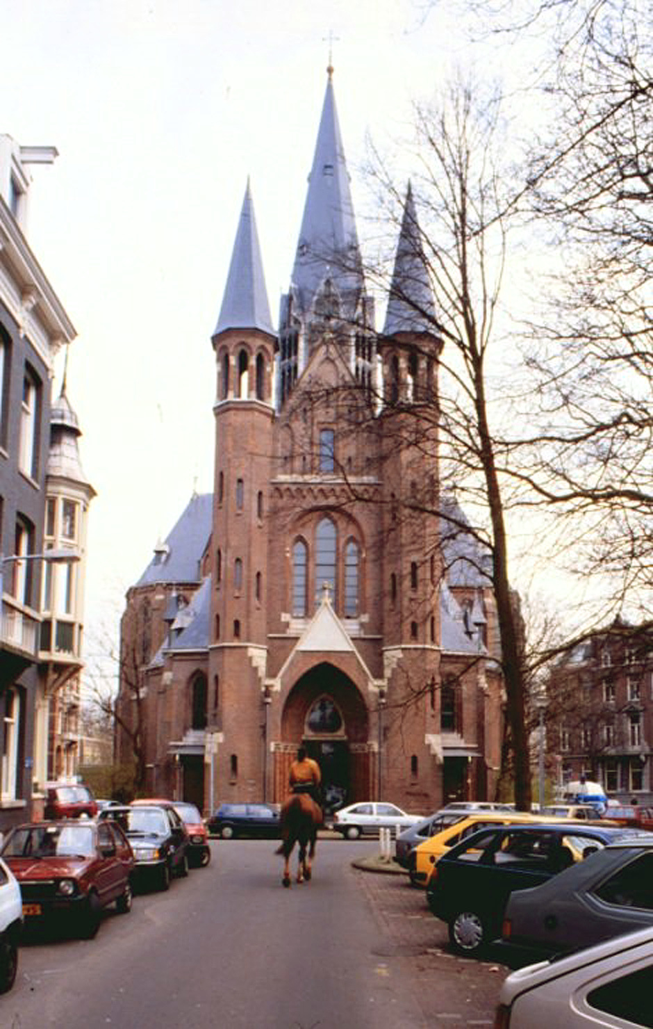
Nederlands: Vondelstraat 120A, Amsterdam. R.K. Heilig Hartkerk (1870-1880, architect dr. P.J.H. Cuypers, toren na brand in 1904). Neogotische kerk met bijzondere centralistische plattegrond en centrale achthoekige toren.
|
||
| Datum | 30 oktober 2007 (originele uploaddatum) | ||
| Brón | Transferred from nl.wikipedia to Commons. | ||
| Sjriever | De originele uploader was Eriksw op de Nederlandstalige Wikipedia |
| Objectlocatie | | Deze en andere afbeeldingen in: OpenStreetMap |
|---|
Licentie:

|
De auteursrechhöbbende van dit bestandj steit ederein toe 't veur willekäörig wèlk doel te gebroeke, mids de auteursrechhöbbende correk mitte naam wört geneump.
Heroetgave, aafgeleide wèrke, kommärsiejeel gebroek en al anger vorme van gebroek zeen toegestange. |
Attribuusje:
|
| This image is copyrighted but may be used if the source is acknowledged as the Amsterdam Municipal Department for the Preservation and Restoration of Historic Buildings and Sites (bMA). This applies only to images for which bMA does not mention some other source.
If you use images from the site, bMA would appreciate it if you would send a copy of your publication to bMA, City of Amsterdam, Keizersgracht 123, 1015 CJ Amsterdam, The Netherlands. |
Orzjineel uploadlogbook
The original description page was here. All following user names refer to nl.wikipedia.
- 2007-10-30 00:04 Eriksw 940×1480×8 (429146 bytes) {{bmz}} Vondelkerk, Vondelstraat
Besjtandshistorie
Klik op 'ne datum/tied óm 't besjtand te zeen wie 't oetzaog op det tiedsjtip.
| Datum/Tied | Miniatuurplaetje | Aafmaetinge | Gebroeker | Kómmentaar | |
|---|---|---|---|---|---|
| hujig | 24 apr 2008 23:41 | | 940 × 1.480 (419 kB) | BotMultichill | {{BotMoveToCommons|nl.wikipedia}} {{Information |Description={{nl|Vondelkerk, Vondelstraat. Het originele bestand staat [http://www.bmz.amsterdam.nl/adam/pics/groot/vondelk1.jpg hier] en wordt [http://www.bmz.amsterdam.nl/adam/nl/bouwm/cuy.html hier] ge |
Plaetjesverwiezinge
Dit plaetje weurt op de volgende pazjena's gebroek:
Globaal besjtandjsgebroek
De volgende anger wiki's gebroeke dit bestandj:
- Gebroek in ca.wikipedia.org
- Gebroek in de.wikivoyage.org
- Gebroek in en.wikipedia.org
- Gebroek in es.wikipedia.org
- Gebroek in eu.wikipedia.org
- Gebroek in fa.wikipedia.org
- Gebroek in fr.wikipedia.org
- Gebroek in fy.wikipedia.org
- Gebroek in he.wikipedia.org
- Gebroek in nl.wikipedia.org
- Gebroek in pt.wikipedia.org
- Gebroek in qu.wikipedia.org
- Gebroek in sr.wikipedia.org
- Gebroek in sv.wikipedia.org
- Gebroek in www.wikidata.org
- Gebroek in zh.wikipedia.org