
Plaetje:California map showing Yuba County.png
Gein hoeger resolutie besjikbaar.
California_map_showing_Yuba_County.png ((200 × 231 pixel, besjtandsgruutde: 22 kB, MIME type: image/png))
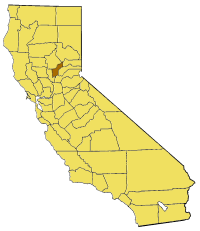
Map of Yuba county in California. From en:

|
Toesteumming wert verleend veur t kopiëre, verspreide en/of wiezige van dit document onger de veurwaerd van de GNU-licentie veur vrieje documentatie, versie 1.2 of einige latere versie es gepubliceerd door de Free Software Foundation; zonger Invariant Sections, zonger Front-Cover Texts, en zonger Back-Cover Texts. n kopie van de licentie is opgenomme in de sectie GNU-licentie veur vrieje documentatie. |
| Dit bestandj steit gelicenseerdj óngere Creative Commons Attribution-Share Alike 3.0 Unported lisensje. | ||
| ||
| Dees licentie-tag woort tougevoeg aon dit bestand in verband mèt de GFDL licentie-update. |
derivative works
Afgeleide werken van dit bestand: California map showing San Diego County.png
Besjtandshistorie
Klik op 'ne datum/tied óm 't besjtand te zeen wie 't oetzaog op det tiedsjtip.
| Datum/Tied | Miniatuurplaetje | Aafmaetinge | Gebroeker | Kómmentaar | |
|---|---|---|---|---|---|
| hujig | 14 jul 2005 17:32 | | 200 × 231 (22 kB) | Pyramide~commonswiki | Map of Yuba county in California. From en: {{GFDL}} Category:Maps of counties in California |
Plaetjesverwiezinge
Dit plaetje weurt op de volgende pazjena's gebroek:
Globaal besjtandjsgebroek
De volgende anger wiki's gebroeke dit bestandj:
- Gebroek in en.wikipedia.org
- Template:YubaCountyCA-geo-stub
- Sugar Pine Peak
- Greenville, Yuba County, California
- Arboga, California
- Challenge, California
- Frenchtown, Yuba County, California
- Hammonton, California
- Horstville, California
- Oak Valley, California
- Oregon House, California
- Sicard Flat, California
- Strawberry Valley, California
- Waldo Junction, California
- Woodleaf, Yuba County, California
- Condemned Bar, California
- Oat Hills (Yuba County)
- Sand Hills (California)
- Trainer Hills
- North Yuba River
- Camp Far West Reservoir
- Jack Slough
- Yuba County Superior Court
- Gebroek in pam.wikipedia.org
- Gebroek in www.wikidata.org