
Plaetje:California map showing Alameda County.png
Gein hoeger resolutie besjikbaar.
California_map_showing_Alameda_County.png ((200 × 231 pixel, besjtandsgruutde: 22 kB, MIME type: image/png))
| Besjrieving |
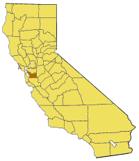
English: Map of Alameda county in California. |
| Brón | From en:wiki |
| Sjriever | user:Pyramide |

|
Toesteumming wert verleend veur t kopiëre, verspreide en/of wiezige van dit document onger de veurwaerd van de GNU-licentie veur vrieje documentatie, versie 1.2 of einige latere versie es gepubliceerd door de Free Software Foundation; zonger Invariant Sections, zonger Front-Cover Texts, en zonger Back-Cover Texts. n kopie van de licentie is opgenomme in de sectie GNU-licentie veur vrieje documentatie. |
| Dit bestandj steit gelicenseerdj óngere Creative Commons Attribution-Share Alike 3.0 Unported lisensje. | ||
| ||
| Dees licentie-tag woort tougevoeg aon dit bestand in verband mèt de GFDL licentie-update. |
Besjtandshistorie
Klik op 'ne datum/tied óm 't besjtand te zeen wie 't oetzaog op det tiedsjtip.
| Datum/Tied | Miniatuurplaetje | Aafmaetinge | Gebroeker | Kómmentaar | |
|---|---|---|---|---|---|
| hujig | 1 jul 2005 18:51 | | 200 × 231 (22 kB) | Pyramide~commonswiki | Map of Alameda county in California. From en: {{GFDL}} Category:Maps of counties in California |
Plaetjesverwiezinge
Dit plaetje weurt op de volgende pazjena's gebroek:
Globaal besjtandjsgebroek
De volgende anger wiki's gebroeke dit bestandj:
- Gebroek in bg.wikipedia.org
- Gebroek in en.wikipedia.org
- Altamont, California
- Monument Peak (Milpitas, California)
- Mount Allison
- William Joseph McInnes Botanic Garden and Campus Arboretum
- Grand Lake, Oakland, California
- Murray Township, Alameda County, California
- Brooklyn, California
- Alvarado, California
- Decoto, California
- Elmhurst, Oakland, California
- Sequoyah Heights, Oakland, California
- Grass Valley, Oakland, California
- Seminary, Oakland, California
- San Leandro Oyster Beds
- Adams Point, Oakland, California
- Labadie Arboretum
- Maxwell Park, Oakland, California
- Sunol Valley
- Ridgemont, Oakland, California
- Trestle Glen, Oakland, California
- Old Oakland
- Grizzly Peak (Berkeley Hills)
- Westbrae, Berkeley, California
- Cragmont, Berkeley, California
- Lorin District, Berkeley, California
- Oakmore, Oakland, California
- Network of Bay Area Worker Cooperatives
- Crocker Highlands, Oakland, California
- Best Manufacturing Company
- Template:AlamedaCountyCA-geo-stub
- Bethany Reservoir
Bekiek wikiwied gebroek van dit bestandj.